Satellite Imagery
Remote Sensing and Artificial Intelligence (AI)
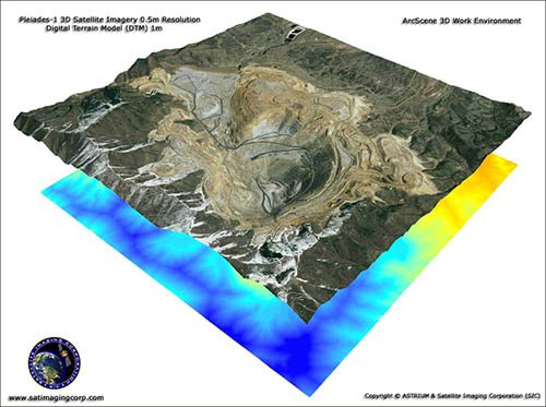
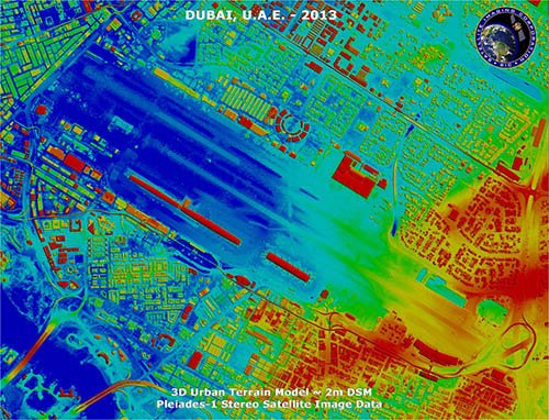
Satellite Imaging Corporation (SIC) specializes in satellite imaging collections, producing seamless orthorectified imaging mosaics, DEMs (Digital Elevation Models), and 3D Digital Terrain Models (DTMs) for many industries using CAD and GIS applications utilizing high, medium resolution mono and stereo satellite image data.
The latest technology to capture precise and accurate data over large areas from satellites, unmanned aerial vehicles (UAV), and aircraft has been the utilization of Artificial Intelligence (AI), Machine Learning (ML), and Computer Vision (CV). AI and ML models have great success in many apllications requiring large amounts of image data to aid in pattern recognition and create algorithms through computer systems.
AI and ML can help the end data user to understand the data collected in order to find resolutions for particular projects rapidly. AI can improve in the analysis of large areas of interest, to classify objects and identify features, detect and monitor land use, data fusion, cloud removal, and spectral analysis of environmental changes from satellite or aerial imagery.
ML a subdivision of AI can help the end-user to understand the data collected in order to find resolutions for processing image data and to improve the overall accuracy, classification, and can enhance the reliability and assessment of the features of data collected that will overcome challenges of remote sensing data.