Industries
Inspections
Many government agencies have complex and expensive operations that can be time-consuming and expensive to inspect. Enterprise drone inspection systems are being used in a variety of industries, including oil and gas, energy, agriculture, critical infrastructure, public safety, and mining, to name a few examples. Organizations looking to conduct professional aerial inspections and collect data now have an affordable option in drone technology. In order to improve their operations, reduce costs, and keep their employees safe, they can use drone-based data effectively.
A drone inspection is the process of evaluating an asset with the help of an RPAS. Operators can remotely view the asset via the video downlink with a drone. Drones have the ability to reach places that are challenging, expensive, unsafe, or even impossible to reach by personnel. They can be used indoors, underground, onshore, or offshore, and they can be used for a variety of applications including inspections and surveillance.
There are numerous advantages to using a drone for inspections. Working in potentially hazardous positions is no longer necessary for the inspection crew to do their duties. It is possible for you to collect the data with the drone while your staff remains on safe ground and away from potentially hazardous places. There are several ways in which enterprise drones save money, from the reduction in labour requirements to the elimination of the need to install scaffolding or other temporary safety equipment.
Aside from that, drones can assist you in maintaining the continuity of operations and assets while important inspections are performed. Downtime can be reduced, or even eliminated, which can result in significant financial savings. Using drones for inspections can significantly reduce the amount of time the process takes. Drone inspection is a more cost-effective and efficient inspection method, allowing for more frequent checks to be performed. Any problems can be fully recognised and resolved much more quickly as a result. Using drones, you can capture high-quality data that can be stored to build a comprehensive record of an asset’s lifecycle.
Drones may carry out automatic, repeating missions, ensuring that the data is consistent from one mission to the next – something that is very important for frequent and comparative checks.
Visual Inspections
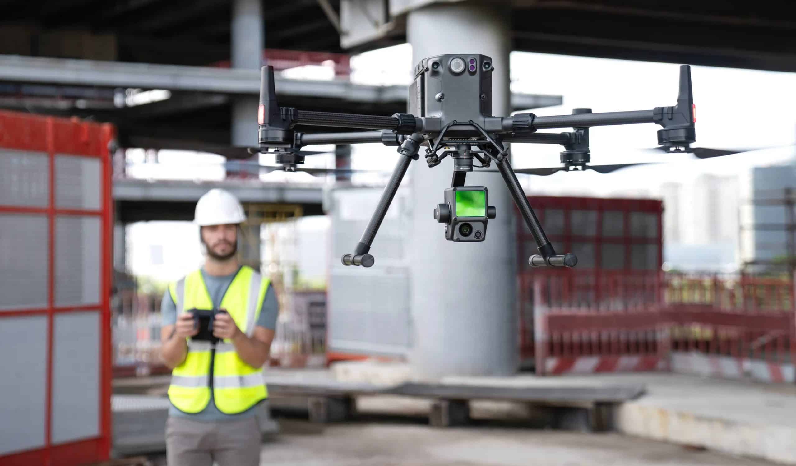
When conducting a complete visual inspection of an asset, whether it’s a power line, wind turbine, or a structure, it’s important to be as specific as possible. Using this method, the imagery can be acquired during a brief drone flight and then examined in greater detail later. When a drone is used for this type of inspection, it eliminates the need to shut down a facility. A critical component of a visual survey is the use of a zoom camera to focus in on a specific region of interest. There are various advantages to doing so. The use of a zoom camera provides a better level of detail, allowing inspectors to detect minor flaws, rust, and missing pieces without having to shut down the production line. The use of zoom allows for the acquisition of this information from a distance, minimising the hazardous and time-consuming manhours associated with climbing and keeping employees away from potentially dangerous circumstances.
Thermal Inspections
Thermal imagery captured by a drone is particularly useful for utility and construction-related inspections. They are able to detect concerns such as missing or damaged installation, water under roof membranes, external electrical difficulties, failing windows, and a variety of other issues. Drones equipped with thermal cameras may inspect solar panels to detect manufacturing problems, cracks, faulty interconnectors, and temporary shadowing, among other issues. In addition to its ability to detect and highlight faults that could otherwise go undetected during a visual inspection, a thermal camera has other advantages. In order to bring about efficient resolutions, operators rely on data to make informed and timely judgments.
Working in the hazardous materials industry, where volatile and toxic compounds are present, is a high-risk business proposition. When doing this type of inspection, drones can save time and money by removing the need for humans to physically access the location. The use of drones for HazMat inspections is becoming increasingly popular, as they can detect substances such as vapour, chemicals, and radioactive materials. In turn, this minimizes the amount of entries that employees must make, which improves safety while also speeding up the inspection process overall. While boosting safety, drones are capable of streaming footage or collecting data that may be shared remotely to assist with decision-making.
Surveying and Mapping
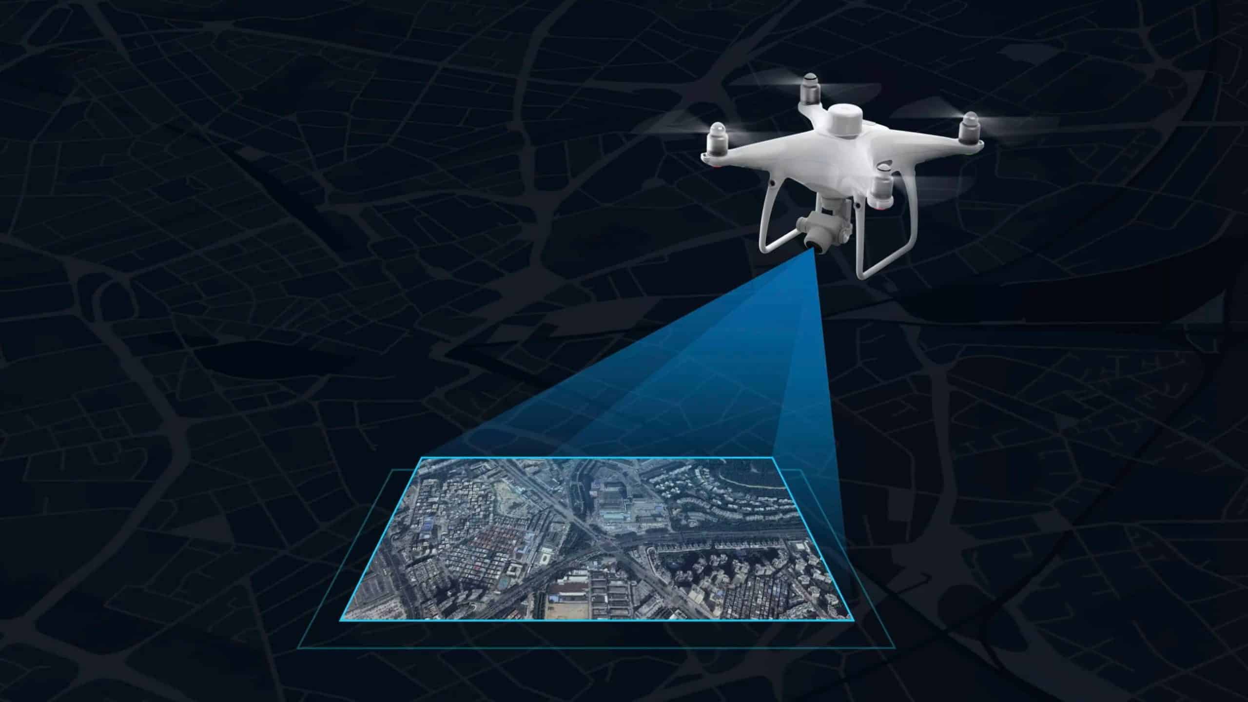
There are numerous advantages to using a drone for survey work. This includes being able to collect precise data quickly and safely, as well as affordably, which can then be used to improve decision-making and provide crucial insights. Drones have been effectively integrated into surveying workflows to do land surveys, photogrammetry, 3D mapping, topographic surveying, and more because of their capacity to capture data from above. It is possible to benefit from drone surveys across numerous industries, from construction to agriculture to land management to public safety and environmental research, to name just a few. Drones can collect a massive amount of data very quickly by employing sensors such as RGB cameras, multispectral cameras, or LiDAR payloads.
A variety of assets, like 3D maps and elevation models, can be created from this data. Valuable information can also be generated, such as very precise measurements and volumetric computations. As a result of this information, it is possible to make educated decisions and gain vital insights. This would include discovering faults or problems and keeping track of a project’s progress. Aerial surveying using RPAS has developed into such a vital tool that it is now utilised for land surveying, roof inspections, bridge/building assessments, infrastructure maintenance, and construction sites.
2D Mapping
Surveying software can assemble hundreds or thousands of digital photographs taken by your drone to create high-quality 2D orthomosaic maps.
An accurate 2D map can be beneficial for a variety of applications across a wide range of industries, including the building and infrastructure sectors.
These maps and photographs provide a realistic representation of the situation, allowing for more quick decision-making and analysis of how a project is proceeding.
3D Surveying
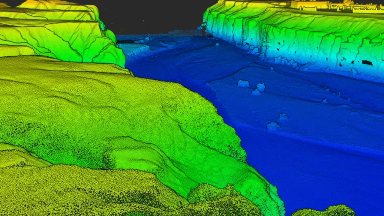
Due to the low cost of deploying drones, you’d be able to gather aerial images or video on a regular basis to develop 3D models. The ease with which you may capture visual data allows you to generate real-time 3D models that would be prohibitively expensive if done by helicopter. You can create a digital surface model (DSM), a digital elevation model (DEM), or a digital terrain model (DTM) using 3D data (DTM). In a Point Cloud, a 3D visualisation made up of thousands or possibly millions of geo-referenced points can be created. High-resolution data and an interactive 3D model with real-world pictures are provided by point clouds. These can be used to inspect the job site or to offer detailed information on how the job is proceeding on-site to clients or stakeholders. Additionally, point clouds may be utilised to create digitised models of structures for use in CAD and BIM applications.
Stockpile measurement / Volumetric Analysis
Using drones, stockpile measurements can be made by creating volumetric models. Stockpile measurements with GPS or other standard devices are constrained by the limited sample data which may be gathered. Drones may gather data with ground sample distances as small as one centimetre instead of utilising a spot grid with a point every five metres, leading to more precise sampling and data collection.
By automating the stock measurement process, we can save numerous man-hours which would otherwise be spent physically measuring material. It is advisable to use the same drone that is used for surveying and mapping for volumetric analysis and stockpile measurement. Using these drones to measure stocks of various materials is ideal because of their high-resolution photos and centimeter-level GPS.
Thermal Mapping
Aerial infrared thermal surveys (IR) of structures, complexes, universities, military bases, and cities can be utilised for a wide range of applications. Surface temperatures and patterns can be used to monitor supply steam and condensate return lines, hot water lines, chilled water lines, supply water mains, distribution pipework, storm water drains, and sewage lines. In the case of district heating systems, thermal data may be gathered quickly and cheaply to aid in asset management and predictive maintenance planning. It is possible to reduce energy consumption and the associated advantages by locating and correcting steam system leaks.
Asset management can make use of the heat emitted by underground steam lines. Thermal imaging can discover steam pipes that are overheating or have a leak by measuring the amount of heat they radiate. Ecosystems, leisure, and human consumption all depend on water quality. The temperature of the water on the surface can be monitored to find out where the water gets warmer or colder. Natural springs can produce both warm and cool water, depending on where the water comes from. Thermal energy emitted at night can be used to detect energy leaks in both business and residential structures. Improved utility use and less energy waste can be achieved by focusing on buildings that lose heat.
LiDAR:
Using lidar, which stands for light detection and ranging, high-resolution models of the ground’s elevation may be created with a high degree of vertical accuracy, enabling for more precise mapping. The laser scanner sends brief pulses of light to the ground surface, which may be detected by the human eye. Those pulses are reflected or scattered back, and the time it takes for them to travel between the laser scanner and the ground is used to determine the distance between the scanner and the ground. Initially, Lidar data is collected as a “point cloud,” which is a collection of individual points reflected from everything on the surface, including buildings and vegetation. Structures and vegetation are removed from a Digital Elevation Model (DEM) to create a “bare earth” Digital Elevation Model (DEM). With the help of reliable Digital Elevation Models, you can easily build topographic maps that will be useful in land surveying applications. Aerial LiDAR payloads can also assist you in managing the entire project lifecycle of architecture, engineering, and construction surveying, thanks to the accuracy of the point clouds and 3D models produced.
Forestry has made extensive use of lidar as well. Airborne lidar devices can be used to measure canopy heights, biomass, and leaf area. Similarly, several sectors, such as energy and railway, use lidar as a speedier surveying method. Lidar data can also be used to create topographic maps. Lidar can quickly and cheaply produce high-resolution datasets. For analysis and interpretation, Lidar-derived products can be easily integrated into a Geographic Information System (GIS).
When it comes to archaeology, Lidar may be used for everything from determining where to go on a field trip to mapping features hidden behind the canopy of trees. Digital elevation models (DEMs) of archaeological sites can also be created using Lidar, which helps show micro-topography that is otherwise obscured by vegetation. If you ‘re mapping infrared, you can utilise the strength of the returning lidar signal to find things buried beneath flat vegetated surfaces like fields. Infrared light reflected back from plants is affected by the presence or absence of these traits.
Geomorphology has made great progress thanks to high-resolution digital elevation maps provided by airborne lidar Using lidar, scientists have been able to uncover new information about the physical and chemical processes that shape landscapes, such as river terraces and river channel banks, glacial landforms, the land-surface elevation beneath vegetation, and spatial derivatives of elevation with higher spatial resolution. The biodiversity of plants, fungi, and animals can also be estimated and assessed using lidar.
Agriculture
Drones, which are becoming increasingly ubiquitous on farms around the world, may soon become as common on agricultural fields as tractors. Drone use in agriculture enables farmers to enhance revenues and productivity at a lower cost while also reducing their environmental effect. The use of drones to monitor crops can be more precise and less expensive than traditional approaches, and they can provide valuable insights into crop development as well as identifying inefficient and unproductive practises. Using drones, farmers can create 3D maps rapidly and affordably, which may be used to assist them in making critical decisions about seed planting pattern design and nitrogen control.
Drones can capture multispectral data, which can be used by farmers to gain valuable insights about the health of their crops. Early intervention is critical in resolving any concerns that may arise. The use of drones outfitted with monitoring equipment can be used to identify parts of a field that are suffering from hydric stress (lack of water). Thermal sensors provide critical information that allows for the focused diagnosis of locations that are receiving excessive or insufficient water. Unmanned aerial vehicles (UAVs) can fly over a potential planting zone to check the ideal growing conditions. Afterwards, they can drop biodegradable pods into the ground that are loaded with seeds and nutrients.

Drones have the ability to cover big areas quickly while spraying liquids with pinpoint accuracy and have the potential to play a significant role in the insurance industry, both before and after a claim is filed. Site inspection, claims judgments, fraud prevention, and risk management are all made easier with the use of a drone. Drones are being used by farmers to monitor their cattle. Drones equipped with loudspeakers can be used to detect animal movement by playing a pre-recorded sound in some circumstances.
The application of new technologies in agriculture is playing an increasingly important role in increasing the efficiency of major farming operations, and multispectral technology is no exception to this. The data collected by multispectral sensors mounted on drones can help operations become increasingly effective by providing information that enables for more efficient use of resources and more localised applications, among other things.
Crop inspection is a critical element of farming, and a drone can be used to collect information that is quick, accurate, and valuable. Zoom, infrared, multispectral, NDVI, and vision cameras can all be carried on board drones, allowing them to acquire accurate data that cannot be seen with the human eye or is impossible to obtain from the ground. As a result, agricultural specialists are able to spot concerns quickly, precisely, and reliably, as well as better target their field scouting.
Multispectral sensors are capable of detecting even the smallest changes in the health of crops. This is due to the fact that multispectral imagery captures a vital section of the light spectrum for studying plants (712–722 nm), known as the red edge band, which is captured by multispectral images. Stress begins to manifest itself in this area of the spectrum when the first indicators of stress in a plant appear. Stress has been linked to disease in the plant in some instances. Growers may diagnose, monitor, and track disease-related stress by using the analytics created by the red edge band on their plants. It is how multispectral sensors can assist producers in detecting disease earlier and acting more quickly to prevent the spread of the disease.
Drones can be deployed to do these surveys on a regular basis, or as frequently as the work requires. Having precise and repeatable drone data over a long period of time enables for improved planning and monitoring of improvements, such as ditches and changing fertiliser treatments, over time.
As an extra benefit, this valuable data may be processed promptly and shared with important personnel and decision-makers in real time, allowing them to assist in increasing agricultural yields.
ENERGY INDUSTRY: OIL AND GAS
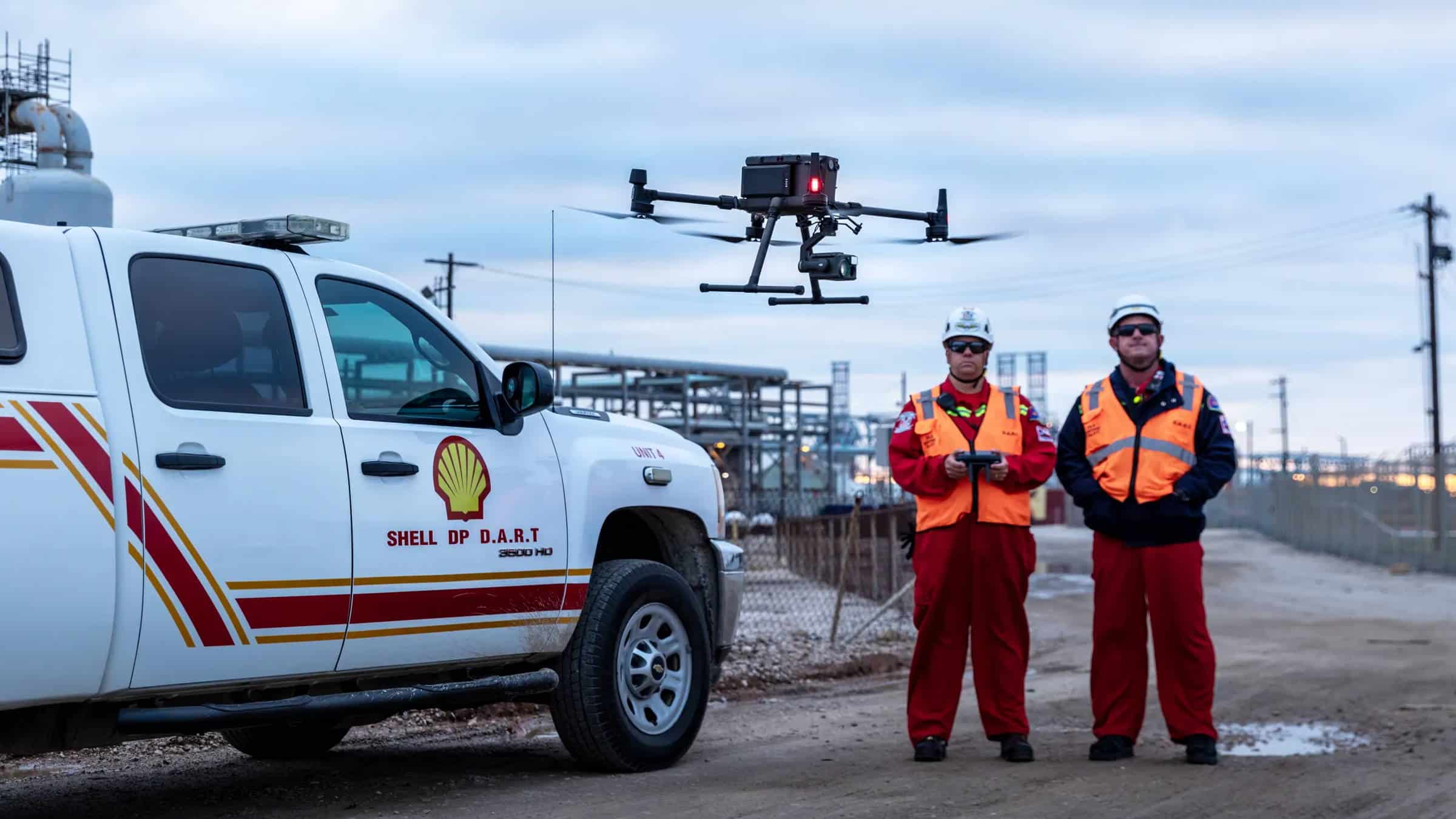
Drone solutions allow you to inspect assets intelligently and manage them with minimal downtime. Inspection, mapping, and monitoring of facilities such as flare stacks and cooling towers may be done quickly and remotely from the ground without interrupting operations.
Reduce risks by keeping workers protected from hazardous sites and materials, while addressing asset issues as fast as possible with the use of drones. Keep operations going while vital checks are carried out with the help of a wide range of cameras and sensor systems. Thanks to automated, repeatable operations, you can obtain precise aerial data and immediately identify asset irregularities. Routine inspections and safety monitoring performed by drones increase efficiency while preventing operations from being halted or crew safety from being jeopardised.
Traditional leak detection methods are incapable of determining the full extent of the leak and during the course of an investigation into a leak, personnel may be exposed to harmful gases. Operations are frequently required to be interrupted in order to address issues in the plant or conduct inspections, which results in a loss of value. It is difficult to manoeuvre and operate specialised detecting equipment because of its high cost and complexity.
The process of detection of leaks can be rapidly and precisely carried out using drones equipped with specialised sensors while maintaining the safety of employees, and allowing for timely decision making. Drones can also cover large regions in a few flights, allowing you to test for leaks and assess the extent of the leak. With flexible payloads and gas detectors, one can significantly minimise the expenses associated with the acquisition of detection equipment. Teams can visualise the leak and respond more swiftly to it if they have access to digital live streams of the detection progress. Automated drone flights can be used to conduct frequent facility patrols and routine safety inspections, while simultaneously documenting crucial findings and major issues in real time.
Survey-grade drones can be used to create high-definition 2D maps and 3D models of facilities and vertical structures, and they can also be used to digitally illustrate inspection results. Operations are frequently required to be interrupted in order to address issues in the plant or conduct inspections, which results in a loss of value. Explosive stacks, oil tanks, and cooling towers are all potentially dangerous environments for inspection employees to enter. Larger locations necessitate the use of a large number of manhours. Because of the limitations of mobile devices, data collection may be insufficient.
In order to inspect complicated structures while operations continue, it is necessary to deploy a solution that causes the least amount of value loss possible. Using drones, it is possible to obtain thorough overviews of the entire site, including all portions of high-rise constructions, without endangering the lives of anyone working on the ground level. Create digital copies of inspection reports for use in coordination with other departments, recordkeeping, and more efficient project management.
Power
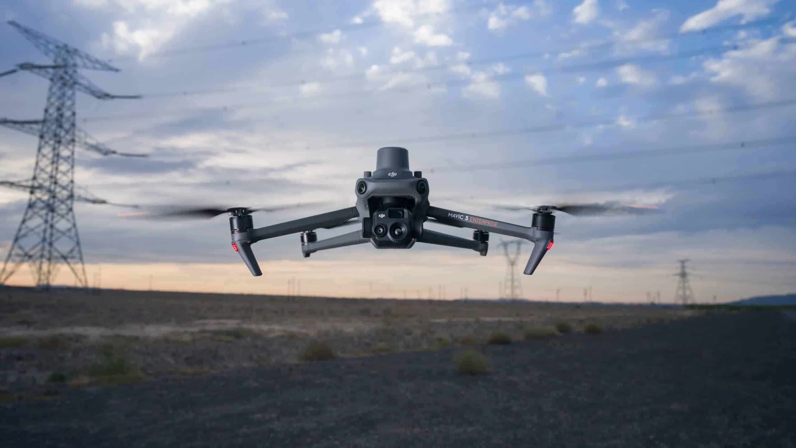
One of the most difficult inspections in the energy industry is to do is to inspect power lines. This is because power lines travel a long way and are at high altitudes, which makes it hard to keep them in good condition. However, powerline inspections are still important to keep the grid from failing and cutting off electricity to a lot of people. Manually, it can be hard to check more than one or two power lines a day. With drone technology, productivity goes up manyfold.
Using traditional manned aircraft methods is an expensive and time-consuming proposition that also necessitates a specific site for safe takeoffs and landings. Because manned aircraft cannot follow the landscape closely enough to maintain a safe flying altitude, it is difficult to adequately represent corridors in mountainous regions. Flight route planning, execution, data export, and data processing together may still take days to complete.
Drones can be used in distant places at a lesser cost than manned aircraft because they are small and easy to transport. It is possible to safely fly a drone over a wide range of terrains thanks to intelligent characteristics that follow the terrain. For applications with a short turnaround time, 3D models can be generated in real time.
Drone solutions provide complete and precise data on all portions of the grid, automating inspections and allowing for faster response times for repairs, and decreasing downtime.
Drones can be used to capture the status of an asset from multiple angles, allowing you to identify and address any faults or defects as soon as they are discovered. Drones equipped with a spotlight can also be used to conduct inspections in low-light conditions or at night, allowing you to identify and address issues faster.
Power line corridors can be quickly mapped, resulting in accurate 2D and 3D models that may be used to assess the distance between vegetation and power lines, assisting in the maintenance of a safe clearance distance. With drones, you can conduct regular, on-demand inspections to keep an eye on the grid’s safety, dependability, and integrity, all while increasing productivity and reducing risk. Start gathering standardised inspection data from automated drone inspections that are accurate in identifying faults. Drones equipped with radiometric thermal sensors can take real-time temperature readings of assets, allowing you to detect anomalies in real time.
Wind ENergy
Additionally, wind energy is a significant source of renewable energy that requires regular maintenance. Over time, cracks, fissures, and other structural faults can develop in a wind turbine, which can reduce its efficiency and cause it to fail. The blades of a wind turbine can wear down over time, producing chips and cracks that not only limit the turbine’s ability to generate energy, but can even fail completely, resulting in a potentially hazardous collapse. The generator and gearbox of a wind turbine must also be inspected on a regular basis to detect any malfunctions. It is more cost effective and time efficient to detect problems with a wind turbine as soon as they are identified.
If you rely solely on manual inspections, there are numerous faults that can go undetected until it is too late to fix them at a reasonable cost. Using a drone equipped with a zoom camera, you can see sections of the wind turbine that are unreachable to humans. It will be possible to detect any additional problems with the wind turbine, generator, or gearbox thanks to thermal imaging capabilities that will be available.
Solar Energy
Solar panels are a major source of renewable energy throughout the world, but as with all energy systems, they require regular checks to ensure that they are performing as expected. The size of a solar farm and the location of some panels can make it difficult to discover problems with solar panels manually over time. This is especially true if any of the panels are in tough-to-reach regions. Instead of physically inspecting each panel with a handheld thermal camera, which may take days, a drone equipped with a thermal camera can complete the examination in a fraction of the time while preserving the precision and quality of the data collected from the panels.

A drone can assist you in identifying any problems with your solar panel system, whether you’re monitoring the overall performance of your system or inspecting it for warranty claims. Drones can swiftly and correctly discover any problems with your solar panel system. Solar panel concerns such as solar cell degeneration or failure can be detected with thermal cameras, which can be used to pinpoint the exact position of the problem. This is particularly useful when dealing with large solar panels in remote areas. Any aspect that reduces the efficiency of your solar panels will result in money and energy being wasted, which is why drones are essential for optimising the output of a solar panel installation.
Nuclear Energy
In today’s world, nuclear power is one of the most efficient sources of energy accessible. To be safe, nuclear energy facilities must be managed in accordance with severe operational requirements, due to the great danger of disaster if something goes wrong with the reactor. Because nuclear materials can offer substantial safety threats to inspection personnel, remote inspections are the most effective technique to reduce risk across the board. Drones can safely check nuclear power plants to verify structural integrity and operational safety, according to the Nuclear Energy Institute. Drones can inspect difficult-to-reach sections of nuclear power plants from a safe distance because to advances in zoom technology.
Technicians at nuclear power plants have traditionally gained access to big concrete structures such as containment buildings, cooling towers, and other large concrete structures by using scaffolding, hanging platforms, or people baskets—or even by rappelling from the top. These methods increase the possibility of worker harm. Drones can help to reduce risk, costs, and disruptions to plant operations by reducing human error.
It is possible that traditional inspection methods, particularly in nuclear power plants, can be hazardous on a number of levels. For many, the standard method of doing a routine inspection or maintenance is to send a human into a specific place, equipped with the appropriate safety equipment and a Geiger counter to measure radiation levels. Fortunately, drones have provided a significantly superior alternative.
Firefighting, Search and Rescue, Law Enforcement
When firefighters arrive on the scene, smoke, buildings, and other obstacles can make it difficult to determine the extent of the fire and the threat it poses. Limited ground perspectives on a fire can make it difficult to allocate attention and resources in the most effective manner. In the immediate wake of a fire outbreak, surveying and documenting the damage can be a dangerous and expensive endeavour.
Thermal cameras mounted on drones allow pilots to fly over buildings and obstructions while seeing through smoke, which assists them in prioritising targets. They also allow you to synchronize teams and eliminate uncertainty, real-time video intelligence can be streamed to command centres. High-resolution cameras can be used to remotely monitor any leftover threats and document any damage for future investigation.

It is becoming increasingly common for firefighters to use new aerial tools, such as multi-gas detectors and thermal and visual cameras, to make quick and informed decisions in volatile emergency situations.
The use of drones in your operations can provide real-time aerial intelligence and help guide the best possible response to protect people and property. Scanning large areas and quickly identifying firelines, assessing the threat they pose, and optimising response are some of the aspects of firefighting that are made possible by the use of drones.
Law Enforcement
Ground teams might struggle with blind spots and thus are exposed to unnecessary risk if they do not have adequate mission data. Inadequate situational intelligence makes it difficult to allocate resources efficiently in order to maximise safety while minimising response time. In order to assist informed actions, law enforcement organisations are implementing adaptable drones to aid in crisis response, fast mapping, and reconnaissance, while also assuring the highest level of safety for police and onlookers.
To help incident commanders make confident judgments, drones give operators the ability to deliver accurate, real-time insight into the progress of missions. You can quickly and remotely map, record, and preserve crime scenes, automobile collisions, and other events, all while keeping operators out of harm’s way and out of harm’s way themselves.
Congested streets can make it difficult for cops to arrive on the scene quickly, causing further response protocols to be unknown and thus causing delays. Manual tools for collecting collision reconstruction data are time-consuming and inefficient, putting police at risk for extended periods of time.
By incorporating drones into your operations, you will be able to fly over accident sites and gather high-resolution 3D evidence for future study, as well as circumvent traffic congestion and roadblocks to reach on scene promptly and select the best course of action. This leads in shortened forensics and data collection times, as well as clear roadways and a greater level of overall safety for everyone.
Search And Rescue
Rescue missions are fraught with inherent dangers for first responders, which can be worsened by insufficient situational awareness. When the target areas are large and the terrain is difficult, rescue crews can be stretched thin. Search and rescue attempts are hampered by the nighttime and low-light conditions, which make rescue missions substantially more difficult.
Aerial imaging with high resolution can be used to scan large areas and identify hazards to victims and first responders as well as increase the awareness of first responders while increasing the efficiency of search and rescue operations.
The use of thermal sensors during the night or in low-light settings can aid in the recovery of missing persons who might otherwise go unnoticed. When responding to a crisis, every second counts, and difficult terrain and conditions can cause reaction times to be delayed significantly. Victims and rescue teams are exposed to dangers in disaster zones, which can be exacerbated by a lack of clear information and communication. Inadequate information on the impacted region can make it difficult to prioritise relief efforts and identify priority targets.
With drone integration into the mission, the pilot can fly over obstacles and risks to acquire quick perspective, and then begin delivering care to those in need of assistance. An airborne perspective can aid in the navigation of ground troops, the facilitation of communications, and the synchronisation of rescue activities. Rapid 2D and 3D modelling of impacted areas can be used to create actionable maps that can be used to lead disaster relief efforts.
Media
Even the most advanced photography equipment can’t keep up with drones’ ability to fly in places that no other device can. A rock-solid, steady shot can be captured by a drone from 200 feet in the air, which was previously impossible. There is no way a helicopter could have gotten that close, and helicopters are too large and cumbersome to be able to access all the locations that drones are able to, let alone fly as low as drones can.
If you’re looking to capture high-speed chase scenes or any other scene that would be difficult to film using a more conventional method of filming, drones are a great option. As a result of drone technology’s ability to capture fluid, gliding shots, filmmakers can now create scenes that were previously only imaginable.
Drones have it all when it comes to film and media. They allow journalists and producers to go beyond what was previously possible, capturing stunning aerial shots and unusual perspectives with ease and precision. By eliminating the need for human intervention in difficult-to-reach shots and allowing the crew to survey a location before they arrive, drones improve safety as well. Drones allow filmmakers to shoot dolly shots or complicated crane shots in minutes rather than hours or even thousands of pounds’ worth of heavy equipment, thanks to their portability, quality, and flexibility. Numerous professionals in the film and media production industry say that this combination has changed the landscape.
With support for a wide variety of industry standards and file formats, including CinemaDNG, Apple ProRes and ProRes RAW as well as larger sensors, drones have become ubiquitous in the Film and Media industry.