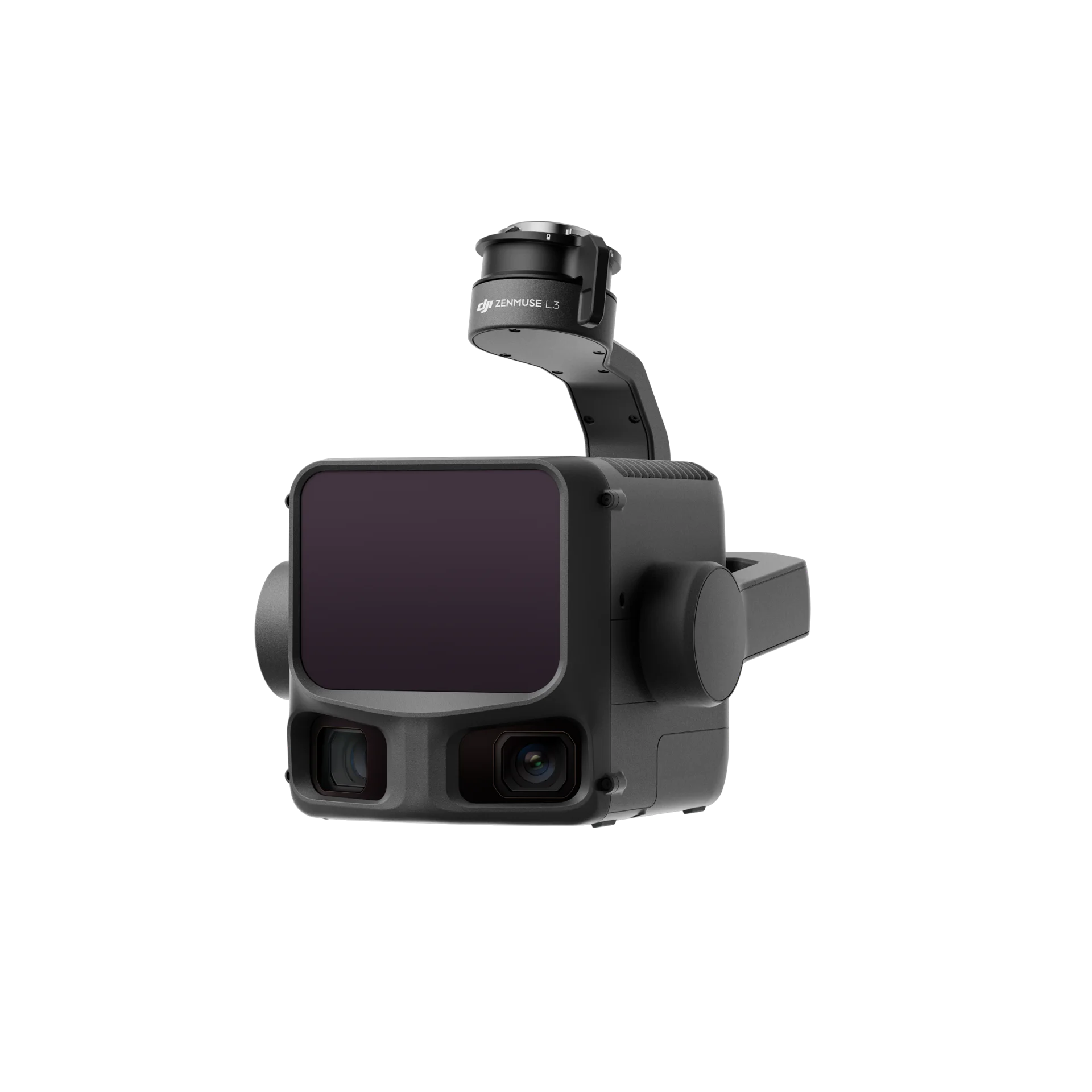
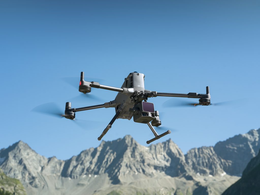
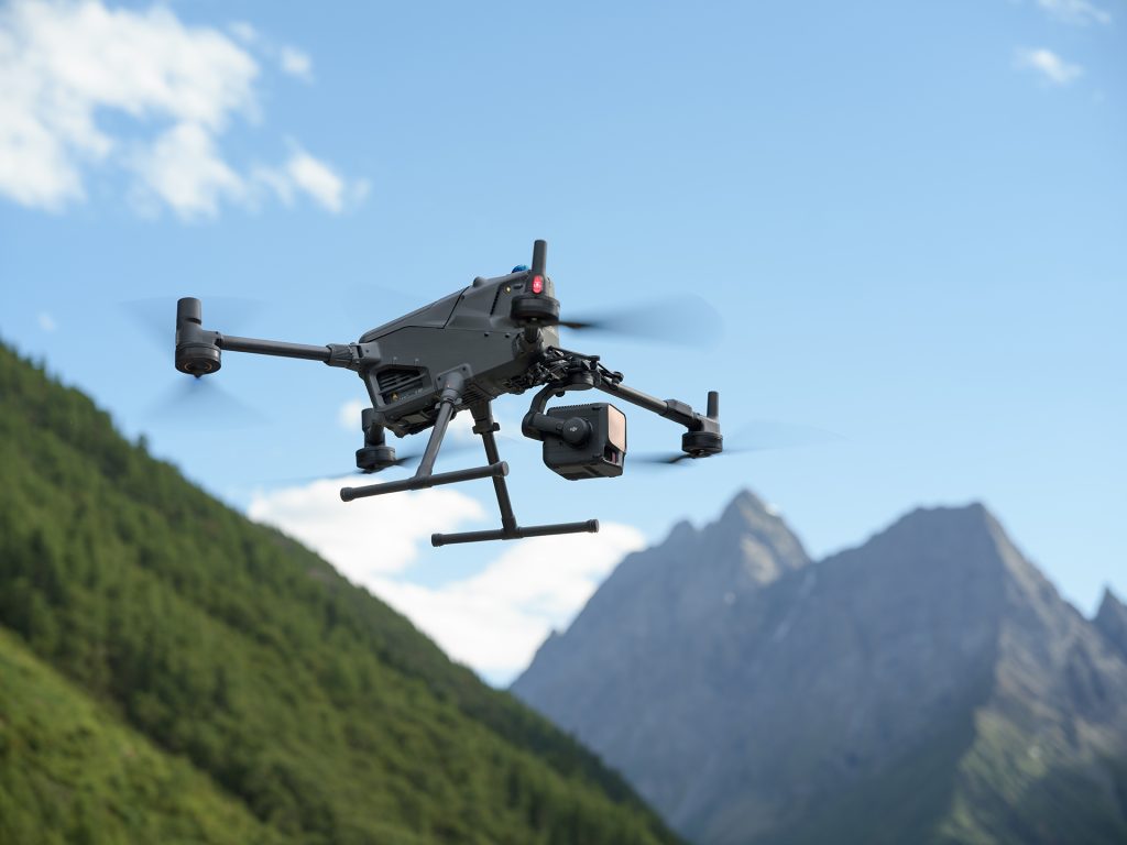
The Zenmuse L3 brings together DJI’s most advanced LiDAR, imaging and inertial technologies in one tightly-integrated system. From open-pit mines to transmission towers, it delivers higher precision, greater penetration and wider coverage than any previous generation.
300–500 m
950 m (@ 10% reflectivity)
2–4 cm
1535 nm Class 1 (Max 100 W)
–25 °C to +55 °C (IP54 Rated)
|
Model
|
Range
|
Typical Accuracy
|
IMU Preheating
|
Camera
|
Key Upgrade
|
|---|---|---|---|---|---|
|
L1
|
80–100 m
|
6–10 cm
|
Required
|
Single
|
First-gen LiDAR
|
|
L2
|
120–180 m
|
4–5 cm
|
None
|
Single
|
Free DJI Terra Processing
|
|
L3
|
300–500 m (950 m max)
|
2–4 cm
|
None
|
Dual 100 MP
|
Long-range flagship with massive sensor upgrade
|
950 m max range (@ 10% reflectivity)
Horizontal accuracy 5 cm / Vertical 3 cm
Real-time Z accuracy 15 cm
Optimised for large-area mapping, mining and infrastructure surveying
Beam diameter 41 mm @ 120 m (20% of L2 size)
Divergence 0.25 mrad × 0.25 mrad
Captures finer details of wires and structures
Stronger vegetation penetration
Point rate up to 2 MHz (100K–2M Hz selectable)
Up to 16 returns for dense canopy penetration
Ideal for forestry, archaeology and geological studies
Linear Repetitive – Highest accuracy
Star-Shaped – Balanced accuracy & penetration
Non-Repetitive – Maximum penetration & coverage
Heading accuracy 0.02° (post-processed)
Pitch/Roll accuracy 0.01°
200 Hz POS refresh rate
Instant startup – no preheating required
Automatic calibration during flight for heading and pitch/roll
Zero manual calibration for manual missions
Dual Micro 4/3 CMOS sensors (100 MP native / 25 MP fast mode)
Up to 1.2 cm GSD @ 120 m / 3 cm @ 300 m
Ultra-wide FOV 107° (27° wider than LiDAR coverage)
Shooting intervals: 1.0 s (100 MP) / 0.5 s (25 MP)
500,000 cycle mechanical shutter
Strong low-light performance
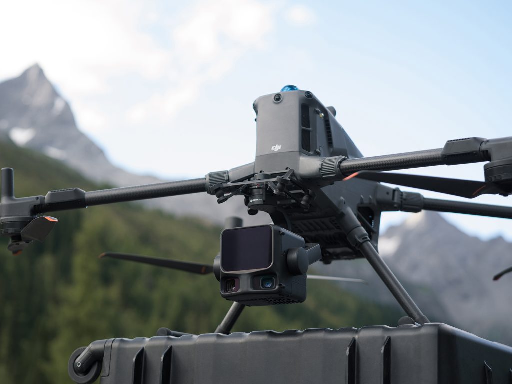
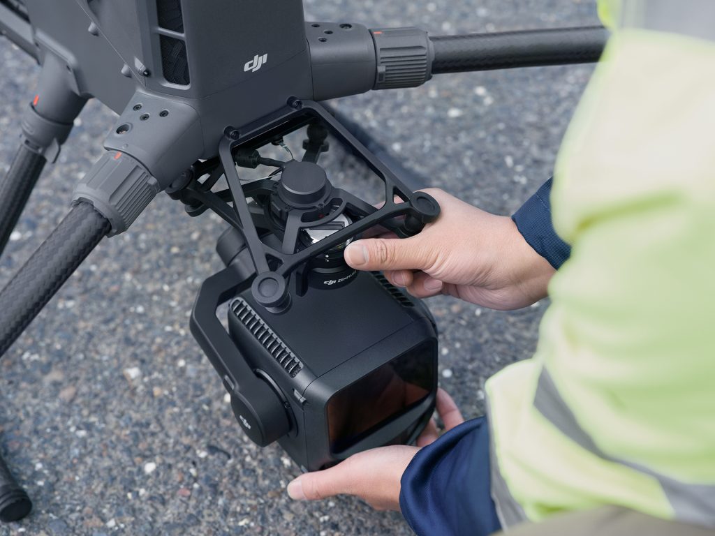
Built for DJI Matrice 400 only
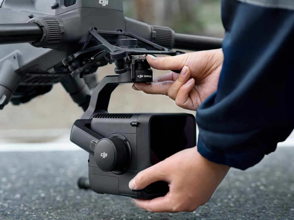
New anti-drop gimbal bracket (included)
Weight 1.6 kg
3-axis gimbal: Pitch –120° to +60°, Yaw –80° to +80°, Roll –90° to +60°
IP54 rated, operational –25 °C to +55 °C
Quick-connect SkyPort mount
Not compatible with M350 due to power draw
FOV 80° × 80°
Transmission lines (10–130 m, optimum 50–80 m)
Distribution lines (10–50 m, optimum 30–50 m)
Terrain following up to 300 m with 10% error margin
Measures distance up to 900 m to centre target (@ 10% reflectivity)
Automatically sets LiDAR point rate and camera resolution based on flight altitude
Point Cloud + Visual
Visual + FPV
Point Cloud + FPV
Real-time point cloud preview on RC
Measure points, lines, areas and volumes live
Emergency mapping mode (5% density, 50% accuracy)
|
Specification
|
Detail
|
|---|---|
|
Laser Type
|
1535 nm, Max 100 W (Class 1)
|
|
Maximum Range
|
950 m (@ 10% reflectivity)
|
|
Recommended AGL
|
300–500 m
|
|
Typical Accuracy
|
2–4 cm
|
|
Spot Size
|
Ø 41 mm @ 120 m
|
|
Point Rate
|
100 kHz–2 MHz (adjustable)
|
|
Returns
|
Up to 16
|
|
Cameras
|
Dual 100 MP Micro 4/3
|
|
FOV
|
107°
|
|
IMU Accuracy
|
Pitch/Roll 0.01°, Heading 0.02°
|
|
Weight
|
1.6 kg
|
|
Operating Temp
|
–25 °C to +55 °C
|
|
Protection
|
IP54
|
|
Compatible Drone
|
DJI Matrice 400 only
|